This was the day I may have both overestimated how long we could stay away, how well New Mexico maintains their roads, and how how good the paper maps I had would be if we found ourselves without service. (spoiler alert: this is the day that nearly killed us.)
We woke up in Santa Rosa State Park at a time that I’d ordinarily classify as “ungodly” but since we were still on East Coast time only seemed slightly deranged. We showered, packed up everything and ate a snack as we drove to Santa Fe where we picked up tofu scramble burittos to go. Yes, I drove all the way to Santa Fe for tofu scramble. No, that didn’t seem weird at the time.
https://instagram.com/p/bZX7HloqTZ/?taken-by=nelizadrew
From there, we drove back south to Cerrillos in time for horseback riding at Broken Saddle. I highly recommend Broken Saddle. Good horses, knowledgeable staff who took no shit when it came to the safety of their horses and riders.
https://instagram.com/p/bapFE8Iqel/?taken-by=nelizadrew https://instagram.com/p/barUZ_IqQH/?taken-by=nelizadrew https://instagram.com/p/barpeyoqQb/?taken-by=nelizadrew

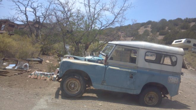
From there, it was down to Albuquerque and then back up to Chaco Culture National Historical Park. They are not kidding about having paper maps handy. I’d printed maps for all our planned routes, the “doodle” of a map on the NHP site, and had a road atlas with us. None of those helped when the rental car got stuck on the road we’d planned to leave on and we had to backtrack to some other road that dumped us out in Istilldon’tknowville. None of the places we’d been were on the maps with enough detail to figure out where exactly we were. (Should’ve brought a topo map. Had one for AZ and NV, but… live and learn and bring a topographical map if you plan to drive that far off a beaten path.) When we finally picked up a bit of signal on his phone, Apple Maps suggested we take “Road of the Ancients” a potentially-neverending dirt path out into the desert after dark. (Pro tip: Don’t listen to Apple Maps.) We decided to keep going on the highway because I had a hunch cobbled from five different paper maps that we’d come up on an intersection to civilization shortly. We did!


Chaco Culture, if you have the maps and enough food and water in case maps and autos fail you, is unreal. I’m not a terribly spiritual person. I commune more with nature than anything else but I have to say that place had a vibe most places don’t. It’s isolated, it’s old, and the rocks have a quality that’s solid yet fragile, precarious but sturdy, hard with soft organic lines. I kind of wish we’d planned to spend the night there, but the park lacks showers and I’m not a fan of spending long days in the car with two people who were horseback riding and hiking and haven’t bathed in two days.
https://instagram.com/p/bbQJx4IqRj/?taken-by=nelizadrew


I had intended for us to take Hwy 57 (Hwy 14 on some maps because why?) out of Chaco Culture. It was supposed to be 20 miles of dirt to Hwy 57 that, roughly 13 miles, later turned into Hwy 9 and connected to Hwy 371, which would dump us onto I-40. Except about 5 miles down the rutted, dirt road, we ran into a spot of soft sand with no way to get around it (trust me, we tried everything including building part of a road out of slate). After way too much effort trying to get past the soft spot, we turned around and went back to the main road and tried the other southern way out of the park. Option 2 included about 33 miles of dirt spread in chucks that nearly gave me a nervous breakdown expecting the next patch of dirt to be the one that got us stuck in the middle of nowhere. We made it to Pueblo Pintado (I guess) as it was getting dark and came to an intersection of Indian Service Roads that weren’t labeled. We picked one way, drove far enough to decide we’d gone the wrong way, and tried the other way. (No phone service out there and none of the maps were helping because without a topo or a street sign or even a school with a town name, we had no way of knowing where we were.)
What I’m saying is: A) I’m insane in that I think an 11.5-hour-drive day with iffy roads is a good idea and B) bring a topo map or a satellite GPS and/or a 4×4 if you go to Chaco.
Here’s something people just don’t tell you about New Mexico, but it’s something you should know if you’re used to driving in places that aren’t New Mexico. New Mexico isn’t crazy about highway reflectors — not even on the interstate — and they have a eh, maybe not attitude toward lights. Yet, their interstate winds around some mountains and over bridges and generally seems way more dangerous than the interstate in say, Florida (well, subtracting those people texting while driving rented Masaratis) or North Carolina (wannabe NASCAR drivers aside), or California (well, maybe not counting those people around L.A. who can’t merge). If you’re sleepy and not from there, it pretty much seems like skydiving while twirling fire.
But, we made it to Holbrook, Arizona. Fun Fact you know you’re in Arizona even if someone steals the big welcome sign because suddenly there are reflectors. (Seriously, don’t drive in New Mexico at night unless you’re a native. Part of their plan is to send the tourists right into a ravine.)
Why Holbrook? Because Holbrook is home to one of the Wigwam Motels, which is a charming little place to stay. If you have kids (or adults) in your party who’ve seen Cars, the Wigwam Motel looks like the little tee pee motel the cars stayed in. Each hotel room is its own giant concrete tee pee and they have their original furnishings (new bedding). In front of each “wigwam” and scattered throughout the property is the owner’s antique car collection and for a clean place to stay, it’s hard to beat the price. (We paid about $45.)
https://instagram.com/p/bbZy9ioqeI/?taken-by=nelizadrew https://instagram.com/p/bbc135IqS5/?taken-by=nelizadrew


Holbrook is also about a half an hour from the entrance to the Petrified Forest National Park and Historic Route 66 runs right through it. (Guess where we’re starting off episode 5.)